Earthquake changed the scene in Japan
Japan Earthquake: As soon as the New Year started in Japan, a dangerous earthquake caused havoc. Tsunami warning was also given due to the earthquake. However, tsunami did not occur. But in the meantime, due to a dangerous earthquake, the view of the beach changed. Here, after the earthquake, the sea went back 820 feet, not just one or two feet. Not only this, after the earthquake the coast of Japan rose up, due to which the sea went back. This is also known from satellite images.
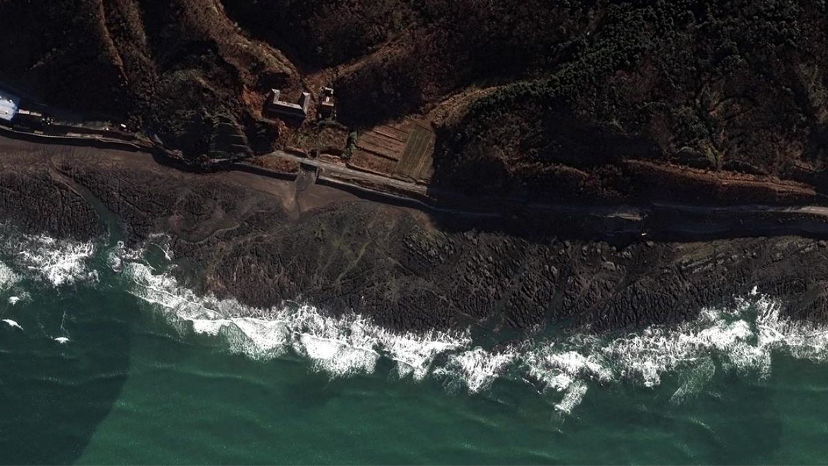
According to satellite photos, after the terrible earthquake that occurred in Japan on January 1, 2024, its coasts have shifted by more than 800 feet. An earthquake of 7.6 magnitude occurred in Japan’s Noto Peninsula on the first day of the year. After the earthquake, people of the Noto Peninsula were asked to move to safe places due to fear of a tsunami. After this, a difference is visible in the land there. Many islands have risen slightly into the sea. Because of this the sea has shifted a little distance.
Many beaches dried up due to earthquake, boat access difficult
From satellite images we can know how much the situation has changed after the earthquake. You will clearly know the difference in the pictures only. Nahel Belgherz has shared these pictures on his Twitter handle. Many beaches have dried up due to the earthquake. Now it has become difficult for boats to reach the shores. These geographical changes have been seen in the Noto Peninsula after the earthquake and tsunami, which can be considered a dangerous situation.
The sea retreated the size of two football fields
If you look carefully at the satellite images, you will see that the places where there was water earlier are now dry. The water has gone way back. About 820 feet back, which is equal to the length of two American football fields. Researchers at Tokyo University’s earthquake research institute have said that after the earthquake, the coastal land has risen at ten places from Kaiso to Akasaki on the Noto Peninsula. That means the sea water has gone down further. This process is called ‘coseismic coastal uplift’.
Confirmed in satellite photos
Tsunami waves 14 feet high hit Akasaki Port. This was revealed from the marks on the walls of the buildings there. Japanese space agency JAXA’s ALOS-2 satellite has also recorded coastal uplift.
Latest World News